
It's been a long while a Grenadier trip was posted, so I'll try to keep it alive.
Our good friend decided to have his birthday party in Copper Mountain, Colorado; we (my brother Nikolay and I) aren't people who fly within a thousand-mile radius, so we packed up the Grenadier and set out.
I also abhor Interstate highways in general and I-15 in particular, so we picked up a path minimizing our exposure to brainless long-distance commute.
Early morning: we're on Interstate 8 making our way towards Anza-Borrego desert. The beautiful part about I-8 is it is nearly empty, 99% of the time.

In a couple of hours or so, we're passing a relic of old days - Space Age Lodge in Gila Bend, Arizona:

Our waypoint for the day: Payson, AZ, and Mogollon Rim. Soon we're through Phoenix/Mesa/Chandler/Gilbert/whatnot, and lumbering uphill along Salt River.

The views along Highway 87 are changing with elevation; organ pipe cacti yield to Joshua trees, then to junipers at 5000 ft, then nearing 7000 feet the pine forest takes over.

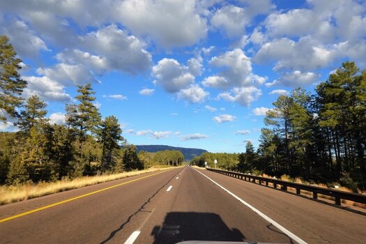
30 miles after Payson, the Mogollon Rim looms over:

We take our time for a detour up Mogollon Rim and take photos looking West. The views here are some of the best in Arizona.


By this time, we've been on the road over 8 hours. Our trip is "front-loaded" - the plan for tonight is to sleep in Durango, Colorado. It is a full gas tank, and over five hours, away.
In Durango, everything is already closed. Gas-station sandwiches and a couple of apples work as our dinner, chased down by Sazerac. This picture's colors and composition are pure Flemish.

Our good friend decided to have his birthday party in Copper Mountain, Colorado; we (my brother Nikolay and I) aren't people who fly within a thousand-mile radius, so we packed up the Grenadier and set out.
I also abhor Interstate highways in general and I-15 in particular, so we picked up a path minimizing our exposure to brainless long-distance commute.
Early morning: we're on Interstate 8 making our way towards Anza-Borrego desert. The beautiful part about I-8 is it is nearly empty, 99% of the time.
In a couple of hours or so, we're passing a relic of old days - Space Age Lodge in Gila Bend, Arizona:
Our waypoint for the day: Payson, AZ, and Mogollon Rim. Soon we're through Phoenix/Mesa/Chandler/Gilbert/whatnot, and lumbering uphill along Salt River.
The views along Highway 87 are changing with elevation; organ pipe cacti yield to Joshua trees, then to junipers at 5000 ft, then nearing 7000 feet the pine forest takes over.
30 miles after Payson, the Mogollon Rim looms over:
We take our time for a detour up Mogollon Rim and take photos looking West. The views here are some of the best in Arizona.
By this time, we've been on the road over 8 hours. Our trip is "front-loaded" - the plan for tonight is to sleep in Durango, Colorado. It is a full gas tank, and over five hours, away.
In Durango, everything is already closed. Gas-station sandwiches and a couple of apples work as our dinner, chased down by Sazerac. This picture's colors and composition are pure Flemish.
Attachments
Last edited: