------------------------------------------------------
Fast paths:
See the version information. Note: Press the reload button of your browser when viewing the contents.
Download the current KMZ file.
Add a workshop, dealer or yourself.
------------------------------------------------------
...
I have tried something which might be helpful when on route.
The idea was to have kind of a map of forum members and dealerships, workshops and so on. My first thought was google maps, but this could only be maintained by those who have a google account. And not everybody wants to log in with his google account at any time.
So I tinkered with googleearth, which is free software and can run on premises without being online and on mobile phones as well. Furthermore, everybody can change the data set which is the basis for this feature, but I'll come back to this below.
To make a long story short: It is easily possible to import data to googleearth and create a layer which can be switched on or off within googleearth - without having to have a Google account. I don't know whether this will change in the future, but this was so since many years and will hopefully stay so for a long time to come.
What did I do?
I would like to call this feature the GRUNT: the Grenadier User Network.
This data set, the GRUNT, should have a worldwide scope and is not limited to a single country. Googleearth is a planet-map, not a district map. ;-)
With the provided download everybody can try it and can (and should) make suggestions for improvements.
Privacy: Everybody can decide which personal data he or she adds or doesn't add to the file. For example, I have my own datapoint located in the middle of my village, which is NOT my precise address.
Attached files:
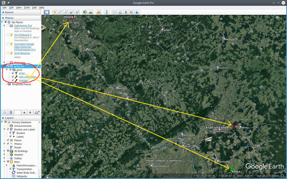
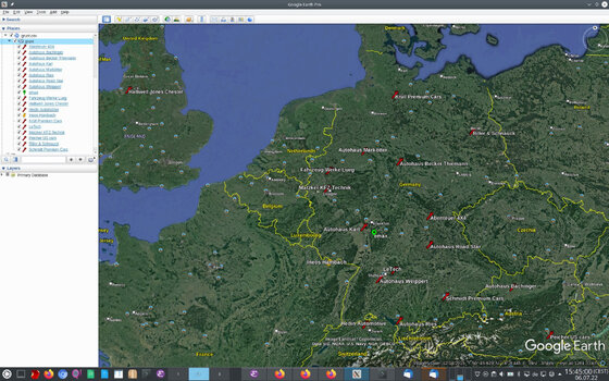
Here is a screenshot of the resulting display for the first, very basic version of the GRUNT file.

Fast paths:
See the version information. Note: Press the reload button of your browser when viewing the contents.
Download the current KMZ file.
Add a workshop, dealer or yourself.
------------------------------------------------------
...
I have tried something which might be helpful when on route.
The idea was to have kind of a map of forum members and dealerships, workshops and so on. My first thought was google maps, but this could only be maintained by those who have a google account. And not everybody wants to log in with his google account at any time.
So I tinkered with googleearth, which is free software and can run on premises without being online and on mobile phones as well. Furthermore, everybody can change the data set which is the basis for this feature, but I'll come back to this below.
To make a long story short: It is easily possible to import data to googleearth and create a layer which can be switched on or off within googleearth - without having to have a Google account. I don't know whether this will change in the future, but this was so since many years and will hopefully stay so for a long time to come.
What did I do?
- I created a small proof of concept example file which contains three data points: 'emax', "Matzker" and "Krah & Enders".
- Each record contains the name, the type and the coordinates of the respective entry.
- This file is easy to maintain as it is a csv-file. It can even be edited as a spreadsheet and then be exported to a csv file.
- The csv file can be imported to googleearth.
- After this, a new layer exists which can be switched on or off.
- The style of the entries is configurable, so I have created such a style which displays a "dealership" entry with an own icon and color, and a "member" entry with an own icon and color as well.
I would like to call this feature the GRUNT: the Grenadier User Network.
This data set, the GRUNT, should have a worldwide scope and is not limited to a single country. Googleearth is a planet-map, not a district map. ;-)
With the provided download everybody can try it and can (and should) make suggestions for improvements.
Privacy: Everybody can decide which personal data he or she adds or doesn't add to the file. For example, I have my own datapoint located in the middle of my village, which is NOT my precise address.
Attached files:
- see above.
- distributed work
- easy data maintenance
- data stays our property (no cloud...)
- redundant copies due to decentralized concept
- easy to extend (with camping sites, landmarks, viewpoints et.al.)
- should work on mobile devices as well (but didn't try)
Here is a screenshot of the resulting display for the first, very basic version of the GRUNT file.

Attachments
Last edited:
